Showing posts with label maps. Show all posts

Sunday, 5 November 2017

Maps and the Genealogist

Old Newspaper article National Railways Western Lines Map depicting Port Arthur / Fort William and Churchill to Prince Rupert and Vancouver Island. BC, Alberta, Saskatchewan, Manitoba, Ontario Larry Walton

“In cartography, as in medicine, art and science are inseparable. The perfect map blends art and science into an effective tool of visual communication.” ~ Dr. Keith Harries

How to travel to a homestead or unofficial placename in Saskatchewan or Western Canada. How to determine distances between contemporary placenames and ghost towns. Do you have an historic document or correspondence which has a placename that you have not heard of previously? The homestead or locality which does not appear on a modern map are an enigma to the traveller trying to find the ancestral home. The genealogical researcher may wish to locate a local history book, or cemetery to glean more information about their family tree, however where would one locate the Saskatchewan place name "End Lake" or "Roderickville" for instance? One very excellent resource is Geographical names in Canada | Natural Resources Canada Looking up a placename for any locale in Canada will produce the latitude and longitude along with a map, legal land description along with nearby placenames and the distance from the longitude / latitude supplied or the distance from the placename searched. Another is the Online Historical Map Digitization Project showing maps, atlases and gazetteers from 1862 to the mid 1950s, genealogists and historians can find a variety of maps are a valuable reference tool for information about places, place names and their locations. Old Newspaper article National Railways Western Lines Map British Columbia, Alberta, Saskatchewan Manitoba, Ontario.  By Larry Walton

Check the two Atlas of Saskatchewan books along with Bill Barry's Geographic Names of Saskatchewan for placenames and their locations book ISBN1-897020-19-2. Saskatchewan local history directory : a locality guide to community and church histories in the Prairie History Room, Our Towns: Saskatchewan Communities from Abbey to Zenon Park By David McLennan and Saskatchewan Ghost Towns are other major resources to help you on your way with your preliminary research online. Search Saskatchewan Placenames amalgmates placenames from the National Archives resources, various books and atlases, and historical maps. An historical location may be defined by the legal land location. How easy is it to locate Roderickville located at section 20 township 15 range 10 West of the third meridian? 
“A map is the greatest of all epic poems. Its lines and colors show the realization of great dreams.” ~ Gilbert H. Grosvenor

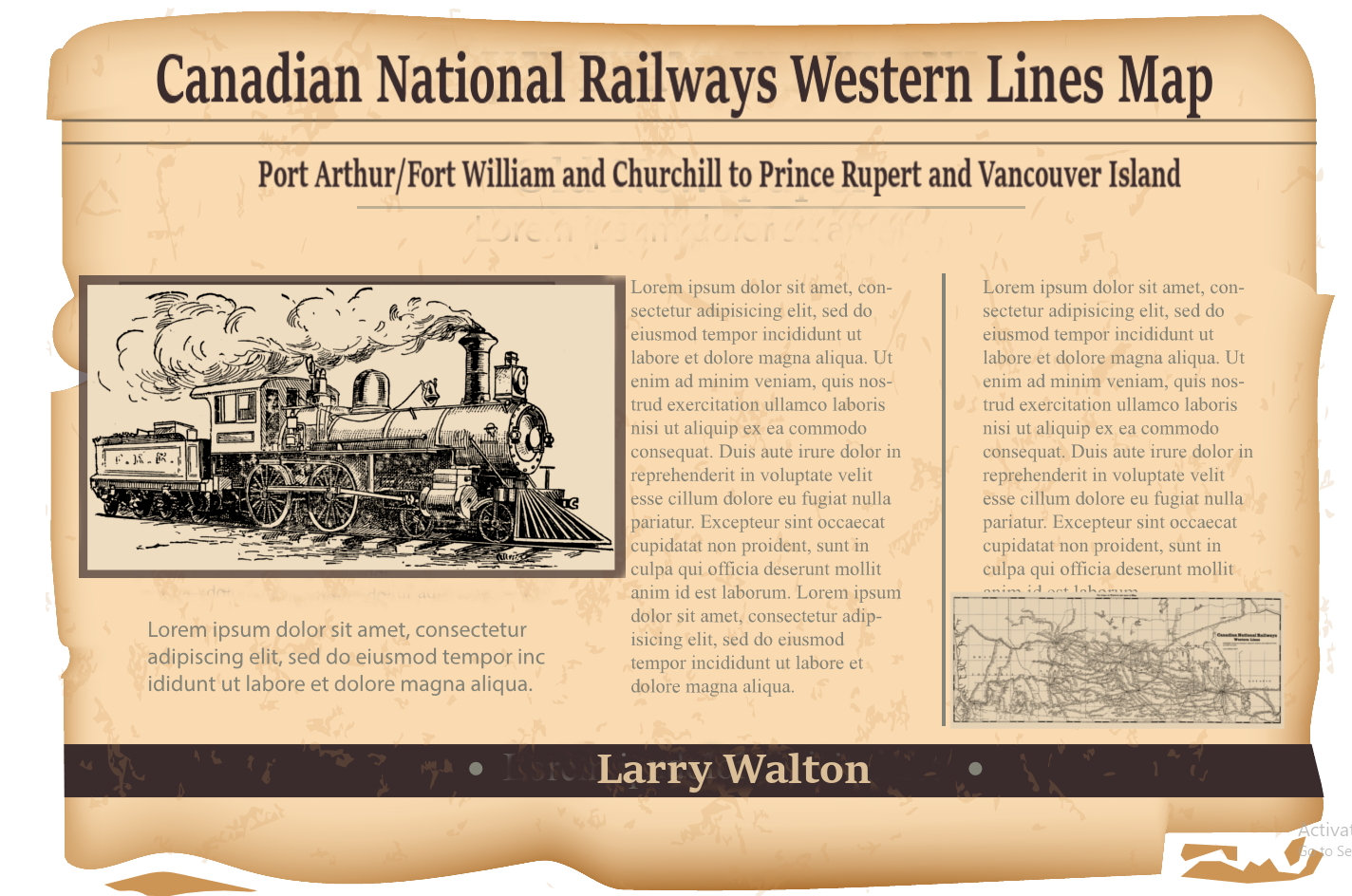
Roderickville appears on Larry Walton's Canadian National Railways Western Lines Map a part of the Online Historical Map Digitization Project and Roderickville also shows up in Geographic Names of Saskatchewan. It then becomes apparent that Roderickville is located just west and south of Swift Current near Rush Lake on the Canadian National Railway. Travelling to Roderickville, now becomes much easier with such bearings. Obtaining a modern Rural Municipality map then provides current roads for the area. The determination of which Rural Municipality needs to be contacted can be derived from one of these maps which will help locate the legal land description, in this case section 20 township 15 range 10 West of the third meridian for Roderickville. This legal land location can be identified by

Rural Municipality Coulee No. 136
Latitude Longitude
50.273554 -107.345313
50° 16.413' N 107° 20.719' W
50° 16' 24.79" N 107° 20' 43.13" W
Township Road 154 Range Road 3105
MGRS/USNG UTM NTS 13U CR 32882 71677 13N 332882 5571678 C-28-C/72-J-6
So by entering in the degrees longitude and latitude into Geographical Names of Canada, the determination is made that: Neighbouring placenames to Roderickville are
  • Braddock 24-13-11-W3 is a nearby Locality 19 kilometers
  • Burnham 16-15-11-W3 is a nearby Locality 9 kilometers
  • Coulee No. 136 is a nearby Rural Municipality 13 kilometers
  • Fauna 16-11-W3 is a nearby Railway Point 16 kilometers
  • Hallonquist 25-13-10-W3 is a nearby Hamlet 19 kilometers
  • Herbert 17-9-W3 is a nearby Town 19 kilometers
  • Neidpath 1-15-10-W3 is a nearby Hamlet l 9 kilometers
  • Rush Lake 1-17-11-W3 is a nearby Village 15 kilometers
By contacting the individual Rural Municipality for their map, driving on township and range grid (gravel) roads becomes very easy to arrive at your destination. Saskatchewan Geographic Perspectives Do you wish to discover how to travel to an unincorporated hamlet? Pay attention to the road signs as you travel along the country gravel road. There is a pattern to the township and range Roads in Saskatchewan as are assigned by the Saskatchewan Provincial Standard System of Rural Addressing.

“I am told there are people who do not care for maps, and I find it hard to believe.” ~ Robert Louis Stevenson

The other method to arrive at Roderickville section 20 township 15 range 10 West of the third meridian would be to use an online legal land converter which determines the latitude and longitude and the GPS bearing for any legal land location. Then plug this number into any GPS system. Ascertaining which localities are close to Roderickville and which Rural Municipality Roderickville is located within, also helps to know which cemeteries are nearby and which local history books are written for the area. Use any library catalogue and type in the rural municipality or larger municipality name. Genealogists may be interested in neighbouring cemeteries to locate an ancestor. In Saskatchewan, a number of the cemeteries are online by a variety of groups, as they are for many countries and provinces across Canada. The Saskatchewan Genealogy Society, for example lists cemeteries by rural municipality.
  • Village population of at least 100
  • Town population of 500 or more
  • City 5,000 residents.
Ghost towns are communities that no longer exist or former Villages/Towns that have become unincorporated hamlets. Delve into some historic maps and placenames which have disappeared from contemporary maps. Before the motorized vehicle was in common use, pioneers and homesteaders relied on horse and cart or ox and buggy for transport to take grain to market, or to drive into town for mail, groceries and supplies. So how far could a horse travel for example? How far a horse travels in one day - Cartographers' Guild suggests;
Horse / Horse and Cart Travel Distances
Geographic surface
Level or rolling terrain: Without a cart With a loaded cart
On Roads / trails 40 miles/day 64 kilometers/day 20 miles/day 32 kilometers/day
Off-Road (or unkempt trails etc)
Hilly terrain: 30 / 51 15 / 24
Mountainous terrain: 20 / 32 10 / 16
Level/rolling grasslands: 30 / 51 15 / 24
Hilly grasslands: 25 / 40 12 / 19
Level/rolling forest/thick scrub: 20 / 32 10 / 16
Very hilly forest/thick scrub: 15 / 24 7 / 11
Un-blazed Mountain passes: 10 / 16 5 / 8
Marshland: 10 / 16 5 / 8
According to Chapter 7 Settlement Evolution since the Late Nineteenth Century. Saskatchewan Geographic Perspectives by Hansgeorg Schlichtmann and M.L. Lewry, towns "were usually spaced 12 to 15 km apart along a railway line so that, in the age of horse-and-cart traffic, a farmer could make a round trip to town and back in one day. Along GTP lines (e.g. the Regina-Fort Qu'Appelle-Melville line) they were rather more closely spaced and, subsequently, more of them have declined or even disappeared more than towns on other trunk lines."

 Local Improvement Districts (LID's) and, Statute Labour and Fire (SLF) Districts improve the local community, establishing cemeteries, honouring war dead, providing health care, roads, bridges. The horse and cart were greatly assisted by the work of the early precursors to the RM and to the Department of Highways and the ensuing Rural Municipality formation. LIDs and SLFs were replaced by Rural Municipalites (RM) following the Spencer Commission findings. Roads were straightened in the 1960s following World War II as more families had access to motorized transport with improved technologies from World War II. When the veterans returned home, society made further improvements. These improvements phased out the need for travel by horse, horse and cart, and ox and buggy. Gradually the extensive railway system saw branch lines closing due to the same phenomena. The one room school house gave way to the consolidated school in town. Families shifted away from the rural farm following the drought and depression in the 1930s seeking economic recovery in the urban centres. The consolidated school also attracted younger families to urban centres and away from living a rural existence.

 "First, farms became larger and the rural population declined, so that the sales volume of small-town stores decreased and many businesses ceased to be viable. Second, motor vehicles became more affordable and highways were improved, thereby increasing mobility. Third, this mobility, along with greater disposable income, enabled rural people to purchase goods and services available in higher-order, more distant central places. Fourth, to achieve costs savings, many smaller grain elevators, and public service facilities such as schools and hospitals were replaced by larger ones, at fewer locations. ...A number of small settlements have disappeared." Schlichtmann

 Good luck on your journey, and have a lot of fun discovering where once there was a thriving and active community of settlers, which may no longer exist. What can be found today? Does the foundation of a store, or a school district flag pole still remain? Here is another mystery; McMichael near Melfort on Larry Walton's Canadian National Railways Western Lines Map. This placename of McMichael does not appear on contemporary maps, and is not discovered by Bill Barry in his book, so what is known of this placename that has disappeared? Are there any other placenames on historic maps which are not listed at Search Saskatchewan Placenames? Lost places collect placenames without a location, and the Search Saskatchewan Placenames seeks to update its listing with new additions as they are submitted.

 Have fun on your genealogical journey discovering what are the neighbouring communities of an ancestral ghost town. By locating a historic settlement it is easier to find resources such as local history books, libraries, museums, historical societies, cemeteries and perhaps a descendant still farming on the "Century Farm" to help discover further information for the family tree. If you are tracking down a historic placename in correspondence or a treasured historic letter, please bear in mind, that pioneers and settlers often referred to their placename where they lived as the name which may be indeed the one room schoolhouse district as it was an integral part of the new community, and settlers gathered together at the school house for meetings, dances, rallies, the Christmas play etc. Julia Adamson ________________________________________________________________________________ Related Posts: Country Roads Leading Home

 Where were Saskatchewan homesteads located?

 How do I locate my Ancestors Home Town in Saskatchewan?

 Locate Your Saskatchewan Place-name

 How did pioneers travel to their prairie homesteads?

 Maybe the Ghosts Will Live Again! Saskatchewan Ghost Towns… Do you have oral history about a Saskatchewan placename not on a current map? How do you find those communities which were once dotted around the prairie every six miles or so? ________________________________________________________________________________ All rights reserved. Copyright © Julia Adamson All my images and text are protected under international authors copyright laws and Canadian photography laws and may not be downloaded, reproduced, copied, transmitted or manipulated without my written explicit permission. They may be licensed through Getty images. .. Peace and love be with you. Namaste. ________________________________________________________________________________ Follow me on Sask Gen Web, 500 px, Word Press, Facebook, Blogger, Twitter, Tumblr, Live Journal, Flickr, and Flickriver ________________________________________________________________________________

Tuesday, 5 February 2013

Saskatchewan Census News Release

The Time of His Life

Saskatchewan Census News Release


It is truly an exciting time for genealogists and historians researching roots in Canada, as public record keeping which began in pre-confederation times, and in the early years of Canada can now be released to the general public. The Dominion of Canada was formed July 1, 1867, which was


Census records provide invaluable information to the genealogical researcher. A primary source record when gives the family members in relation to the head of the family, the address. The agricultural census provides a look at land holdings and livestock to get an idea how a homesteader was faring proving up his land in the early twentieth century.


The census taken every ten years between 1851 to 1911 have been indexed and offered online at ancestry.com. Searchable as well is the census of western Canada taken in 1906 and 1916. This was part of a project initiated in 2008 when the Library and Archives Canada partnered up with Ancestry.ca Additionally the historical census are also searchable online via Ancestry.com covering the era between 1851-1916.


The original holdings of the census or the primary source records are at the Library and Archives Canada. To search for a particular family or surname, the census originals on the LAC web site are arranged by Federal enumeration district. To determine the district you can search for the land location through the homestead (land) records, by reading a local history / family biography book, the census records transcribed on automated genealogy, using a rural municipality or historical map to determine township, range and meridian, searchable database, finding the cemetery, birth, death or marriage (bmd) record which would record the place of residence


Ancestry.ca took it upon themselves to digitize and index the microfilm records in the LAC holdings. At some time the complete digitized records will be available free of charge to visitors of the LAC website. At this time, the Census of the Northwest Provinces, 1906 is fully searchable on Library and Archives Canada by surname, given name, age and province.


When using the census for other years at Library and Archives Canada to locate an ancestral family, a knowledge of historical geography will be of assistance. Saskatchewan became a province in 1905, and before this the population was enumerated as part of the Northwest Territories. In 1882 the Northwest Territories were divided into provisional districts using distinct and different borders than the current provinces.


To determine other Saskatchewan census information and web sites online, a collection is assembled at the Saskatchewan Gen Web Census Information web page. This web page includes the Census for the Hamlet of Insinger, Saskatchewan taken in 1921, the Census for the Hamlet of Duff, Saskatchewan 1920, as well as the Census for the Hamlet of Duff, Saskatchewan 1920 which were compiled online by Sue (Kesiah).


Provincial archives additionally have a number of other village and town census records. These records done on the years when the National census was not being taken were compiled to determine the localities eligibility to incorporate as a town and the need to show the pre-requisite population of 500 or more residents. If a town, the locality may choose to incorporate as a city with a population of 5,000 or more persons, if the census count so warrants.


Public libraries have on file the census 1666-1916 available on microfilm or can obtain it via interlibrary loan if they have a microfilm reader. Along with the Census of Canada, the 1918 Census of Independent Doukhobors: Manitoba, Saskatchewan, Alberta and British Columbia compiled into a finding aid by Jonathon Kalmakoff is available through the provincial archives and libraries.


"Library and Archives Canada is pleased to be part of this collaborative agreement with Ancestry.ca, which" said Mr. Ian E. Wilson, Librarian and Archivist of Canada, "...will truly enhance Canadians' ability to fully explore their documentary heritage and will also be of great interest to those around the world with ancestors who immigrated to or visited Canada."

"This is a win-win relationship for Library and Archives Canada and Ancestry.ca as the partnership," says Josh Hanna, Senior VP, Ancestry International reports, "...will create a seamless flow for digitizing and indexing vast Canadian records and will be a huge benefit to family history researchers in Canada who will soon have the opportunity to access more collections than ever before."


The Church of Jesus Christ of Latter Day Saints also partnered with Ancestry.com providing the expertise, experience and person hours in the indexing of the 1916 census. Family Search now provides the 1871, 1881, 1891, 1901, and 1916 census online . The
1911
census is in the Family History libraries.


First partnering with the LAC back in 2008 in regards to the census, now Ancestry.com is partnering with the Saskatchewan Genealogy Society. Look toward the addition of the Saskatchewan Genealogy Society Indexes in 2013 to the Ancestry.com Canadian collections.


The Library and Archives Canada has indeed become "your gateway to Canadian's past." It is with pleasure and inspiration to see the several diverse communities and organizations come together to share the information in the new digital age. Enjoy the new records being released which provide an insight into diverse peoples and settlers. The information reveals a fascinating insight into Saskatchewan's rich agricultural history and multicultural heritage. ~ Article written by J. Adamson


Further Information:


Census Information


Saskatchewan History and Ethnic Roots


1919 Alberta, Saskatchewan Manitoba Waghorn's Guide


1925 Alberta, Saskatchewan, Manitoba Waghorn's Guide


Gazetteer of U.S. and Canadian Railroads 1922


Saskatchewan Highway Map 1925


Rand McNally 1924 Indexed Pocket Map


Saskatchewan Wheat Pool Maps 1924


______________________________________________________________________________


Bibliography:


Archives Canada Directory of Selected Genealogical Resources.


Canadian Census Collection 1997-2013 Ancestry.com


Censuses of Canada 1851, 1871, 1881, 1891, 1901, 1906, 1911 and 1916. Library and Archives Canada.


The Historical Canadian Census Collection 1851-1916 ~ Ancestry.com 1997-2013 Ancestry.com


Library and Archives Canada Partners with Ancestry.ca ~ What's New ~ Library and Archives Canada Partnership allows unprecedented online access to Canadian historical records.
2008-11-10


Saskatchewan Gen Web Project ~ Census


What to Search Topics: Genealogy and Family History ~ Library and Archives Canada 2011-08-22.


______________________________________________________________________________


Related posts:


Why were Canadian "Last Best West" homesteads created?


The Era of Saskatchewan One Room Schoolhouses


How did pioneers travel to their prairie homesteads?


Where were Saskatchewan Homesteads Located?


How do I locate my ancestor's home town in Saskatchewan? Have you ever visited your ancestral home?


______________________________________________________________________________


Follow me on Flickr, Word Press, Facebook, Blogger, Twitter, Tumblr, Live Journal, 500 px and Flickriver


______________________________________________________________________________


Aum_Kleem - View my most interesting photos on Flickriver


______________________________________________________________________________


Thank you for stopping by, your comments are much appreciated. All rights reserved. Images copyright © Aum Kleem; Article copyright © J Adamson. All my images and text are protected under international authors copyright laws and Canadian photography laws and may not be downloaded, reproduced, copied, transmitted or manipulated without my written explicit permission. They may be licensed through Getty images. Peace and love be with you. Namaste.


______________________________________________________________________________

Friday, 29 June 2012

Uncovering Historical Census and Cemetery Records ~ Answers to Quiz 2

Abundance Abounds


Uncovering Historical Census and Cemetery Records


Here are the answers to the Landmarks and Geophysical Saskatchewan Placenames. Quiz Two. Along with the quiz, Saskatchewan historical information and invaluable resources to locate placenames in Saskatchewan were provided.

Genealogists have much to gain by studying a map of rural municipalities in Saskatchewan. Towns, villages, resort villages and rural municipalities are legislated under The Municipalities Act. The municipality provides services, and facilities necessary and desirable for all or part of the municipality. When seeking ancestral records, rural cemeteries are classified by their rural municipality. The cemetery may be privately run or under the stewardship of the village or local religious community.

Census records canvas individuals by enumeration areas. Rurally the census records the legal land description as the address for each resident. Additionally, the rural municipality has been recorded by the census representative as the residential address in some census years, particularly on the newly released 1916 census records.

Studying historical maps which show the evolution of Saskatchewan's boundaries such as those in the Atlas of Saskatchewan are invaluable to the genealogist to understand the land areas of Rupert's Land, and the districts of Assiniboia, Saskatchewan and Athabasca (also known as Athabaska) in the North West Territories. The area was designated as the province of Saskatchewan in 1905, the North West Territories between 1870 and 1905, and Rupert's Land 1670 to 1870.

Additionally perusing Saskatchewan historical places in conjunction with their modern area names along with rural municipalities and their names facilitates the location of local history and family biography books which were compiled by communities for the 50th and 75th provincial anniversaries.

Quiz Two Answers

1. Algae, Water basin. Answer. Green Lake. Green Lake is a northern village of Saskatchewan which had 361 residents in 2006, the last census. Located amidst the lakes region of Saskatchewan, the village is 17 km (11 miles) from the lake of the same name.

2. Sight, Summit. Answer. Eye Hill. The rural municipality of Eye Hill No. 382 was incorporated in 1910 and locates its offices in Macklin, Saskatchewan. The rural municipality reeve and councilors serve a population between 650 to 700 residents.

3. Grand earth. Answer. Goodsoil. Located in the rural municipality of Beaver River No. 622, Saskatchewan, the village of Goodsoil has a population of about 250 residents. Father J. Shultz and F.J. Lange Sr. came together offering land in the area in 1926.

4. Rapid, Waves. Answer Swift Current. The city of Swift Current makes its home on the banks of the Riviere au Courant or the Swift Current Creek. The creek and Battleford-Swift Current Red River Cart Trail encouraged settlement, and ranches sprang up which were further enhanced by the Canadian Pacific Railway depot and bridge across the creek. As early as 1881, the area had developed a Local Improvement District, and the settlement of Swift Current became a village in 1903. Currently a city of about 145,000 residents along the Trans Canada Highway. An early letter may show the address as SC, ASSA, NWT or Swift Current, District of Assiniboia, North West Territories.

5. Expansive panorama. Answer. Broadview. The town of Broadview, population 611 (2006) received its name from the Canadian Pacific Railway Company CPR in 1882. Historical documents may show the location as Broadview, District of Assiniboia, North West Territories until the province was formed in 1906. Abbreviated the location may read Broadview, Assa, NWT. Assiniboia was demarked as East and West Assiniboia on many historical maps, and Broadview would have been within East Assiniboia, whereas Swift Current (above) would have been located in West Assiniboia.

6. A bend or half turn. Answer. Elbow. The village of Elbow is located within the Loreburn No. 254, Rural municipality. With about 300 persons, Elbow is located on the newly formed manmade Lake Diefenbaker, originally the village was founded upon the South Saskatchewan River in 1909. Lake Diefenbaker is a reservoir created following the construction of the Gardiner Dam on the South Saskatchewan River and the Qu'Appelle River Dam

7. Gigantic, Watercourse. Answer. Big River.
The town of Big River has over 700 residents and is situated in the rural municipality of Big River No. 555. The river through the area was first named by the local Cree. Oklemow Cee-Pee translates into Big River. On historical maps this area would have been a part of Rupert's Land 1670 to 1870. Later historical documents may show the address as either township 56 range 7 west of the 2nd meridian or Big River, District of Saskatchewan, North West Territories between 1870 and 1905. Abbreviated this would be Big River, Sask, NWT. Note; the provisional district of the North West Territories named Saskatchewan does not comprise the same land area as the current province of Saskatchewan. The District of Saskatchewan was only the central portion, between townships 35 and 70.

8. Colour, Meadow. Answer. Yellow Grass. Around 400 persons make their home in the town of Yellow Grass, Saskatchewan. Yellow Grass, had a post office as early as 1896, and it incorporated as a village in 1903 therefore, it would show up on historical documents as Yellow Grass, District of Assiniboia, North West Territories. Located in the south western portion of the province, the Greater Yellow Grass Marsh was responsible for mudslides, and spring flooding in the 1800s and early 1900s. Over 20 dams on the Souris and Qu'Appelle Rivers were required to alleviate the flooding of settlements.

9. Diminutive Mountains. Answer. Little Hills. Little Hills 158—517.20 hectares (1,278.0 acres), Little Hills 158A—38.30 hectares (94.6 acres), Little Hills 158B—131.20 hectares (324.2 acres) are Indian Reserves of about 5 persons located at township 70 range 23 West of the 2nd Meridian about 13 km (8 mi) from the town of La Ronge. These are 3 of the 19 Indian Reserves of the Woodland Cree Lac La Ronge First Nations. La Ronge & Stanley Mission Band of Woods Cree Indians signed Treaty 6 in 1889. Historically the location of the Little Hills reserves was on the border of the North West Territories' Provisional District of Saskatchewan which encompasses township 70, and Provisional District of Athabasca which was north of township 71.

10. Colour, Soil. Answer. Red Earth. Red Earth 29 is an Indian Reserve of 383 residents as well as an unincorporated area or locality found in Carrot River 29A. Red Earth and Red Earth 29 are 5km (3 mi) from each other. Following Treaty 5, signed in 1876, the Red Earth Plains Cree First Nation reside at Red Earth 29 which was first surveyed in 1884 at townships 51, 52 ranges 6,7 W of the 2nd meridian. Carrot River Indian Reserve was surveyed 1894. This would place both historically in the provisional district of Saskatchewan, NWT before Saskatchewan became a province in 1905.

Learning more about the historical evolution of the country, its provinces and regions enables a genealogist to know where their ancestor lived, and where to find current records.

________________________________________________________________________________

Quizzes:
Test your knowledge of Saskatchewan ~ Quiz One.

The Value of Standardizing Placenames for Genealogists. Quiz One Answers.

Landmarks and Geophysical Saskatchewan Placenames. Quiz Two.

For more information:

•Saskatchewan One Room Schoolhouse Project

•Online Historical Map Digitization Project

•Search Saskatchewan Placenames

•How do I locate my Ancestors Home Town in Saskatchewan?

•Maybe the Ghosts Will Live Again
Saskatchewan Ghost Towns...


________________________________________________________________________________

Related Posts:

•The Value of Standardizing Placenames for Genealogists. First Quiz Answers.

•Test Your Knowledge of Saskatchewan's Placenames. First Quiz.

•What can be found at the NEW Saskatchewan Provincial Archives website?

•The Era of Saskatchewan One Room Schoolhouses

•Why were Canadian "Last Best West" homesteads created?

•Love and Marriage in Saskatchewan- a comprehensive guide

•How did pioneers travel to their prairie homesteads?

•Why were Canadian "Last Best West" homesteads created?

•How to locate birth, marriage and death certificates in Saskatchewan, Canada

•Are there genealogy sites that can compete with Ancestry.com?

________________________________________________________________________________________

Follow me on Word Press, Blogger, Facebook, Flickr, Twitter, Tumblr, Live Journal, Sask Gen Web Ancestry.com and Flickriver

________________________________________________________________________________________

Aum_Kleem - View my most interesting photos on Flickriver

________________________________________________________________________________

Buy my work


Inspiring Humility ~ Harebells by Julia Adamson (AumKleem) on 500px.com
Inspiring Humility ~ Harebells by Julia Adamson